Eandis has cooperated with GOconnectIT to test an Augmented Reality application. The average interruption duration on Eandis's power network was low in 2016, due to the reliabillity. The main cause of outage was excavation damage to recently constructed cables and pipes. To excavate carefully is therefore an important focus point and reason to investigate how Augmented Reality can contribute to this matter.
GOconnectIT software combines drawings of cables and pipes from GIS web services with reality images. This works together perfectly with Leica equipment, that enables the software to accurately indicate where cables and pipelines lie according to network operators data. Not everyone has access to these advanced types of equipment, but the software also works on tablets and smartphones. However, the GPS for consumer devices is not yet precise enough for reliable and accurate positioning data. The development in this area proceeds rapidly and it is therefore only a matter of time before the signal strength and accuracy will massively improve.
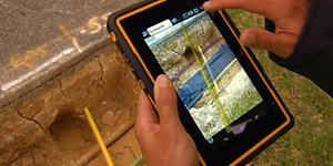
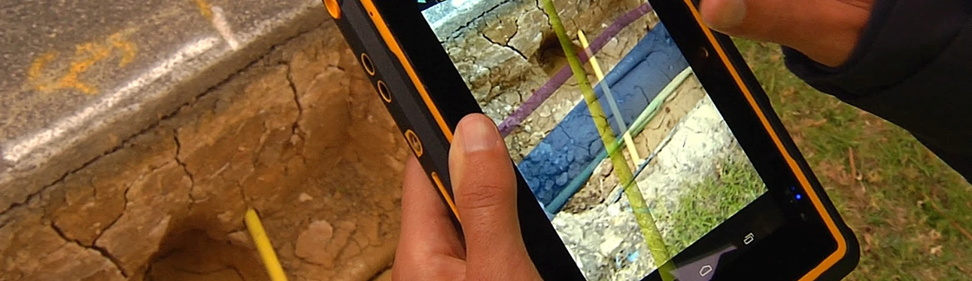
Eandis tested Augmented Reality to view the underground assets in 3D at a closed slot, where all lines in different shapes and colors are shown and the diameter, width and depth are easy to read. Users immediately see who the asset owner is and who uses it.
Augmented Reality can be used for various purposes by organizations in the industry. For asset management, data maintenance and to increase the accuracy of data. But also for support of field communication. In emergency situations, it is crucial to know what assets are in the underground, because that makes it possible to react quickly on the basis of directly available and updated information. The use of Augmented Reality ensures process improvement and cost reduction. This leads to increased user efficiency, improved data quality and a decrease of administrative actions.
Augmented Reality also has another important benefit. Employees who are equipped with this technology are more aware of the environment in which they work because they see cables and pipes projected into the real world. This makes it easier to interpret data correctly, and in this way contribute to prevention of excavation damage. With Augmented Reality, it is possible to provide employees without knowledge of GIS with a tool which enables them to use the power of GIS in an intuitive way with smartphone and tablet.
Data is displayed as a 3D visualization and can be edited by users in the field. Without additional administrative handling, it can be updated directly in systems. Limitations of the use of Augmented Reality on a large scale are currently the compass and GPS functionality of smartphones and tablets. However, with more expensive equipment such as the Zeno 20, Augmented Reality is already very well applicable. Development proceeds rapidly and Augmented Reality will soon penetrate the cable and pipe industry as a disruptive new technology. An excellent opportunity to realize progress through innovation!